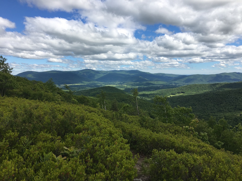
The Shepherd’s Well Trail makes an easy-to-moderate 3.2 mile (500 ft elevation) out-and-back hike with good, dry footing that features an open area with excellent views of south Williamstown, the Hopper and Mount Greylock to the east and Petersburg Pass and the Taconic Range to the west.
Distances: 3.2 miles up and back
Difficulty: Moderate
How to get there
- To access the trailhead, drive 2.2 miles west up Route 2 toward Petersburg Pass.
- Park at the turnout on the left.
- Cross Route 2 carefully at the top of the parking lot, and you will see a white sign for the Sara Tenney Trailhead and then a brown gate. The hike starts on the path just to the left of the gate (RRR Brooks Trail).
Description
The RRR Brooks Trail climbs for 0.6 miles on a beautiful wide trail to the start of Shepherd’s Well Trail (SWT) which is noted on a sign.
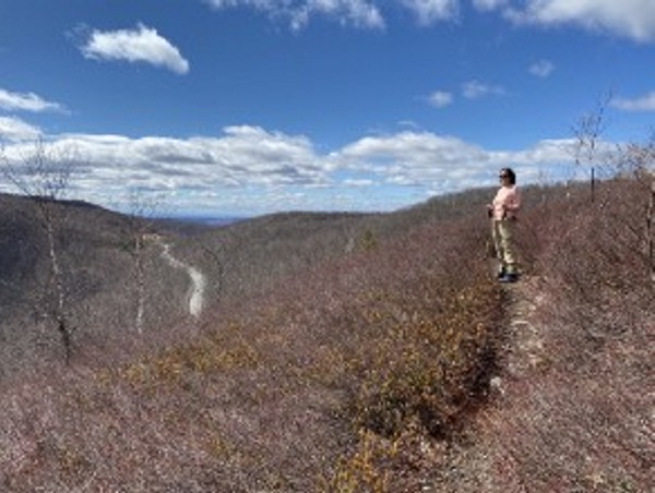
After 0.5 mi. on the SWT (1.1 mi. total), the trail turns and climbs into an open area with fabulous views of Petersburg Pass and the Taconic Ridge to the west and of Mt Greylock, the Hopper and South Williamstown to the east.
Near the end of the SWT (1.5 mi.), look off to the right for a small circular rock structure that is probably the remnant of the well of the Shepherd family. The SWT ends at a junction with the Taconic Crest Trail (TCT) at a T intersection (1.6 mi.). You can then retrace your steps back to the beginning (3.2 mi.). Or, for longer options, you can continue south (left) 0.6 mi. on the TCT to Peterburg Pass, or north (right) 2.2 mi to reach the Snow Hole.