However, there’s so much more out there than the pasture and the cows. The Clark is a jumping off point to a network of trails working their way over and around Stone Hill, a small woods-covered promontory south Williamstown’s town center. Most of the land is Town Conservation land, but the Clark and Buxton School own important pieces of the land in this area as well. Because much of the surrounding lands are privately owned by individuals, please stay on the marked trails.
There are too many trails in the network to describe in full, so here is a favorite loop, a route that “summits” Stone Hill. This route offers many opportunities for a shorter walk, depending on the choices you make at any of the multiple trail junctions. This route specifically takes about 75 minutes, but you might want to take a little longer for some lingering time. The trail network has map kiosks at key points, and the trails are well signed and blazed.
Any of these trails are great trips with family and friends. Because of the multiple route options, you have a lot of choices for length, and the amount of climbing. Some hikers do hike with their dogs off-leash, particular in less busy early morning times. Later in the day, at busier times it’s better for everyone to keep your dog on leash.
Difficulty: Easy
How to get there
Start at the Clark Art Museum’s Lunder Center; this is the building slightly up the hill from the main museum complex, and is accessed by the 2nd entrance driveway coming south from Rt. 2 & 7 on South Street.
Description
From the Lunder Center parking area, look east to find a gravel road that leads up the hill. This is the Stone Hill Road Trail and is marked with red paint blazes and signs. This trail forms the backbone of the network, and is crossed by nearly every trail in the network. A short way up the road, look for one of the map kiosks on the left. Take the Carl Reidel trail (white blazes) into the woods. You will also see a small yellow sign indicating you are on Williamstown Conservation Lands.
The Reidel trail is the most “wild” in the system, a single pathway that climbs somewhat steeply at times (keep an eye out for the white blazes) through oak and hemlock stands to join the orange blazed Hopkins-Gale Trail.
This is your first decision point. Turning right (north) will take you back to the Stone Hill Road and down to your car. Go left (south) and continue to climb (more gently now) passing the 1100 ft. high point of Stone Hill on your left. In this area, look for short branches on the ground beneath the hemlock trees. These have been left by porcupines who gnaw them off the tree and then come down to the ground to feed on the buds and needles.
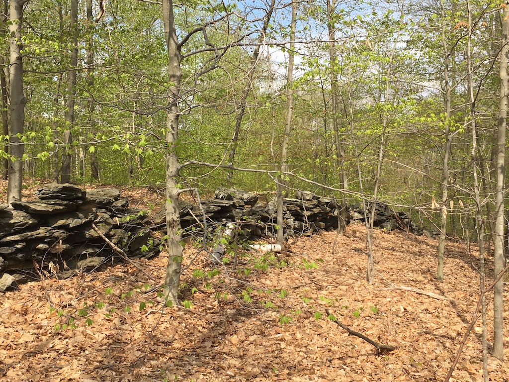
A bit further past the high point, you will arrive at an old stone wall and the junction with the Buxton School Trail (green blazes). You could take this trail back to the Lunder Center.
To continue on our route, pass through the gap in the wall, still on the Hopkins-Gale Trail, and start a gently sloping descent. About 10 minutes after the stone wall, the Hopkins-Gale Trail ends at the Kite Hill Trail (yellow blazes): a T-intersection. A left turn (east) takes you to a small parking area at the end of Cluett Drive. A right turn (west) continues our circumnavigation.
As you walk along the Kite Hill Trail, on the left you may see some trees blazed in blue paint. This is not a trail but the boundary with a private landowner. Please heed the no trespassing signs. The Kite Hill portion of our walk ends at the junction with the Stone Hill Road Trail (red blazes) at a kiosk.
A left turn will take you south, eventually getting you to Scott Hill Rd, a right turn will take you back north towards the Clark campus–you’re about half way through the loop.
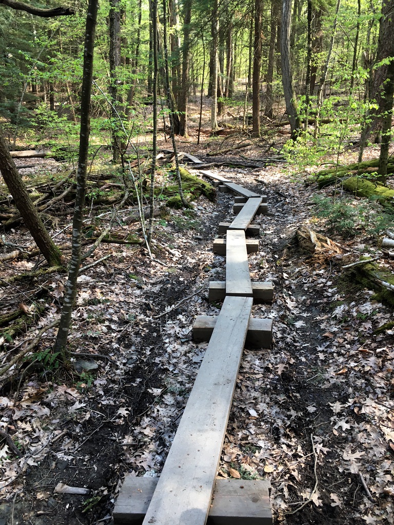
Stay on the Stone Hill Road Trail for approximately 20 minutes. On the left is private land; to the right, notice the rocky cliff. This is likely the home of the hemlock-munching porcupine. This section can also be muddy in spots, as the road does not drain well. The WRL/WOC Trail Crew have installed some bog bridges over the more extensive wet sections.
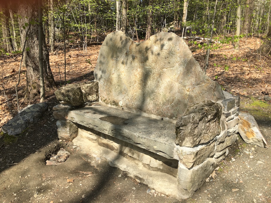
After a very slight uphill section, the Stone Hill Road Trail arrives at a 4-way junction at the Stone Bench and an adjacent map kiosk. The bench honors George Moritz Wahl, a professor at Williams College in the early part of the 20th century. For more info, see Lauren Stevens’ Hikes and Walks in the Berkshire Hills.
At this junction there are more decisions to be made.
A right turn takes you over a small rise to join the north end of the Hopkins-Gale Trail (orange blazes). A left turn at that junction will take you back to the parking area via the Stone Hill Road Trail. Proceeding straight on the Stone Hill Road Trail will take you past the southeast corner of the large meadow that joins the Clark main campus, or you can continue on the road down to the Lunder Center. A left turn (west), takes you on the Stone Bench Trail, unblazed at this point, but easy to follow on a widely mowed path that bends slowly right, passing the buried water tank on the right that supplies water pressure for central Williamstown. The trail passes briefly through a shady hemlock woods before arriving at a gate at the south west corner of the meadow. As with all gates, close it securely behind you; the meadow is an active cow pasture from mid-May to September. The cows are used to people, but please attend to your dog and younger children, the former may try to chase the cows and the latter may be accidentally knocked down by a curious bovine.
Proceed through the field on a mowed trail, joining another trail coming from the southeast corner of the pasture. Bear left at this junction, on the rise ahead, you will see the top of Thomas Schutte’s “Crystal,” a large sculpture overlooking the Clark campus.
Arriving at the crest of the pasture, take in the iconic northerly view of the area. The far ridge line features The Dome, just over the border in Vermont. To its right, the long ridge runs south to Pine Cobble and carries the northern few miles of the Appalachian Trail in Massachusetts. Further to the right is Mt. Prospect, the northern peak of the mountains that surround Mt. Greylock. The Hoosic Range and two groups of wind turbines can be seen on the eastern horizon. In the valley below, church steeples and Williams College buildings can be seen, and in the foreground are the Clark galleries.
Should you wish to return directly to your car, proceed to the right on a mowed path where a gate will lead to a gravel path that will return you to the Lunder Center. You may also proceed down the hill on another gravel path with the option of continuing through the gate onto the campus, or part way down the hill the Meadow Walk will lead you to the right to the northeast corner of meadow and the remaining trails on our loop.
The Meadow Walk ends at the gravel Nan Path, turning right up the hill, crossing two footbridges. A third, longer bridge appears on the left, which will take you back to your car.
This hike is enjoyable year round, and in the winter you will see tracks of coyote, turkey, deer and, yes, the porcupine at the top of the hill.
For any hike, even one as simple as this, always let someone know where you are going and when you plan to return. Dress for the weather and expect some muddy and slippery spots here and there. Water (or perhaps a more robust beverage) and a snack make for a nice break while you gaze northward from the top of the meadow.
Cosmo Catalano, Jr.
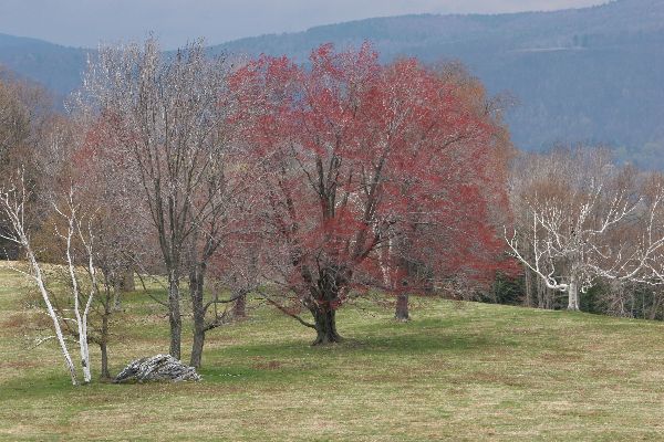
Hike Photos
Click a photo to open in slideshow.